Strathbogie Ranges Conservation
The Strathbogie Ranges Conservation Management Network (SRCMN or Strathbogie Ranges Conservation) was formed in early 2011 and has been going strong ever since. The SRCMN works with a variety of partners (landholders, groups, Agencies) to tackle all sorts of conservation, biodiversity and land management issues, but is focusing on the most threatened ecosystems in the Ranges, including our precious wetlands (springsoaks & bogs), rocky outcrops and high conservation value forests. There are many groups and agencies involved in biodiversity conservation in the Strathbogies, for example:
- Landcare Groups (Warreenbayne-Boho, Strathbogie Tableland, Swanpool, Hughes Creek Catchment Collaborative, Longwood East, Creightons Creek, Whiteheads Creek, Merton etc. Click the map link below.)
- Australian Plant Society (Strathbogie, )
- Euroa Environment Group
- Friends of Euroa Arboretum
- Ruffy Weekend Walkers & Highland Ramblers
- Department of Sustainability & Environment (North-east Regional Office, Arthur Rylah Institute)
- Goulburn Broken Catchment Management Authority (GBCMA)
- University of Melbourne (Zoology, Hydrology)
- Trust for Nature
- Parks Victoria
- Local Government (roadside reserves and planning controls)
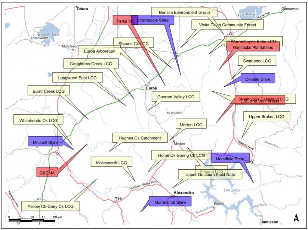
This map shows the distribution of the above groups. And of course there are many landholders that do their best to encourage native flora and fauna conservation on their properties. Many of these groups have activities or responsibilities that include waterways and wetlands. Currently, there is limited communication between these groups and very little coordinated action. A CMN, made up of representatives from each of these groups, may be a tool to better focus our wetland conservation and management efforts, and lead to better outcomes.
Committee
Where are we?
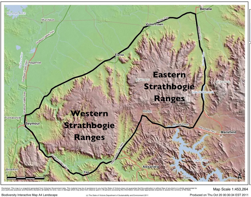
The Strathbogie Ranges are situated in North Eastern Victoria, Australia, surrounded by the townships of Benalla to the north-east, Seymour to the south-west and Yea and Merton to the south. Whilst the Ranges themselves are defined by two large and connected, elevated granitic landscapes, the Eastern and Western Strathbogie Ranges, the Strathbogie Ranges CMN area extends beyond the higher topography, to include all areas within the major Highways that surround the Ranges (Hume Fwy, Goulburn Valley Hwy, Maroondah Hwy, Midland Hwy). Notwithstanding this convenient boundary, any groups or individuals interested in the natural history and ecology of the region are welcome to join in.
For a potted early geological history of the region read this page on Strathbogie Ranges Nature View.
Partners
The Strathbogie Ranges Conservation Management Network, or SRCMN, is committed to partnering any community group and Agency that have a role in advocating or undertaking biodiversity conservation in the Strathbogie Ranges region. In August 2011 we began liaising with Landcare groups and Networks, to begin building partnerships. We are currently building a Steering Committee, comprising a diverse array of land managers, across various land tenures, public and freehold.
Landcare Groups in the Strathbogie Ranges CMN Area
There are almost 20 landcare groups in the SRCMN area: Ancona, Ballmattum-Sheans Creek, Bonnie Doon, Burnt Creek, Creightpn’s Creek, Gooram Valley, Highlands, Home Creek Spring Creek, Hughes Creek, Longwood East, Merton, Molesworth, Strathbogie Tablelands, Swanpool, Upper Hughes Ck, Warrenbayne Boho Landcare, Whiteheads Creek, Yea River, Yellow Creek-Dairy Creek.
Landcare Networks
The district also overlaps several Landcare Networks: Broken Catchment Landcare Network-Gecko Clan, Granite Creeks, Hughes Creek Catchment Collaborative, Upper Goulburn Landcare Network, Up2Us Landcare Aliance.
Other community groups
Other biodiversity focused community groups in the area include: Benalla Environment Group, Euroa Environment Group, Mitchell Environmental, Murrindindi Climate Action , Mansfield Environment and Climate Action Group, Friends of Seymour Bushland Reserve, and others.
Local Government
The SRCMN area is part of five local government areas: Benalla, Mansfield, Mitchell, Murrindindi, Strathbogie.



Private industry
The single largest commercial land manager is Hancocks Plantations, which manages the bulk of the softwood resources in the area.

Government agencies
A variety of Victorian Government-funded ‘agencies’ manage ‘public land’ in our area: Goulburn Broken Catchment Management Authority, Parks Victoria, Department of Economic Development, Jobs, Transport and Resources, Department of Environment, Land, Water and Planning and VicRoads.
